 |
High Quality Windows AVI Movie
Three Bands - Visible, Water Vapor, and Infra Red
A Historic Video
Record for Your Archives !
Save it for the Grandkids.
Let them re-live the Approach and Storm Track
of the big ones of 2005, 2006, 2007, ... you get the picture
Archival Quality !
Save it for the Grandkids.
Let them re-live the Approach and Storm Track
of the big ones of 2005, 2006, 2007, ... you get the picture
Archival Quality !
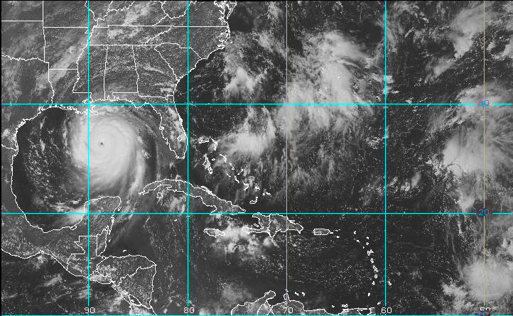
Katrina Clobbered New Orleans. Ike
Iced Texas. Now you can watch these storms as they traverse from
the Atlantic up through the Gulf, crashing into the US coastline.
Watch them grow from tropical depression to Hurricane. One
Continuous Time Lapsed Movie of storm evolution. Sharp, Crisp,
Clear imagery is captured from geosynchronous satellites
orbiting 23,500 miles up in space. You can clearly see
the eye of the storms evolve. You can even see the shadows that
the Sun casts within the eye.
Cool stuff, Why? Because you see different features in the different bands. The visible is crisp detail of clouds and even some ground data. The IR is heat. The Water Vapor absorption band really zeros in on the Hurricanes Moisture content.
- Visible ( 520 - 720 nm)
- Water Vapor ( 6470 - 7020 nm)
- Infra Red ( 10200 - 12500 nm)
- You get six files on a DVD, 2 for each Optical Band:
1) A compressed AVI file (Indeo 5.1), approx. 10 MB.
2) An uncompressed AVI File for clear Original Quality freeze frames, approx. 300 MB.
- Each file has at least one week of satellite coverage in one continuous AVI movie file
- Frames taken at half hour intervals (nominally)
- Frames played back at 24 Frames per second
- 720x480 frame size
Imagery is
provided in three different optical bands
- Visible
( 520 -
720 nm)
- Water Vapor ( 6470 - 7020 nm)
- Infra Red ( 10200 - 12500 nm)
- Water Vapor ( 6470 - 7020 nm)
- Infra Red ( 10200 - 12500 nm)
Cool stuff, Why? Because you see different features in the different bands. The visible is crisp detail of clouds and even some ground data. The IR is heat. The Water Vapor absorption band really zeros in on the Hurricanes Moisture content.
Details
of the AVI File
Set:
- Three Optical Bands
- Visible ( 520 - 720 nm)
- Water Vapor ( 6470 - 7020 nm)
- Infra Red ( 10200 - 12500 nm)
- You get six files on a DVD, 2 for each Optical Band:
1) A compressed AVI file (Indeo 5.1), approx. 10 MB.
2) An uncompressed AVI File for clear Original Quality freeze frames, approx. 300 MB.
- Each file has at least one week of satellite coverage in one continuous AVI movie file
- Frames taken at half hour intervals (nominally)
- Frames played back at 24 Frames per second
- 720x480 frame size
Order your AVI
File Set in Black & White or in False Color


